- This event has passed.
2018 Memorial Hike for Loren Leonberger

Our 7th Annual Hike
Meet at the staging area inside the parking lot of the Avra Valley Airport at 8am. We’ll then caravan to the trailhead, no later than 8:15am. The Avra Valley Airport is also known as the Marana Regional Airport or the Marana NorthWest Regional Airport. Please arrive at the parking area on time so that we can get a head count. We don’t want to leave anyone on the trail. Retired DPS Sergeant Gregg Girard #1151 will be in the parking lot awaiting everyone. His cell number is 602.531.4466.
- It takes about an hour to hike to the accident site from the trailhead. The terrain is steep and the footing loose in some areas. Please wear hiking boots (tennis shoes are not appropriate), long pants, and gloves. Please be sure to bring water to drink and a hiking stick if needed. If you’re wondering if this hike will continue in inclement weather… three years ago 19 brave souls completed the hike in a cold rain.
Below are directions to Waterman Peak (If you decide to bypass the staging area:not recommended)
- TAKE AVRA VALLEY ROAD EXIT OFF I-10, GO WEST (THIS IS THE SAME EXIT TO MARANA AIRPORT)
- DRIVE 18 MILES, TURN LEFT AT A ROAD THAT HAS A LARGE BOLDER ON THE CORNER, AND A BROKEN SIGN THAT SAYS PIONEER ROCK QUARRY (OR SOMETHING TO THAT EFFECT).
- FOLLOW THIS ROAD A COUPLE MILES TO THE PARKING AREA.
- SILVERBELL MINE IS THE PEAK JUST NORTH OF WATERMAN PEAK AND IS READILY VISIBLE.
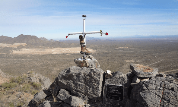
- THERE IS A MEMORIAL TO LOREN ON TOP OF THE PEAK AT THE SCENE OF THE CRASH, WHICH TOOK LOREN’S LIFE ON JANUARY 31, 2011
THE ELEVATION OF WATERMAN PEAK IS 1,123 METERS
GPS OF THE PEAK IS
32°20’59.26” N
111°28’24.41W


